
Smart Surveyor Software: Making Land Surveying Simple and Effective
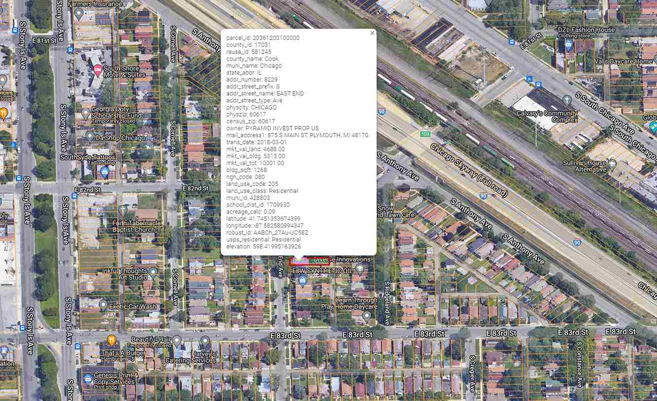
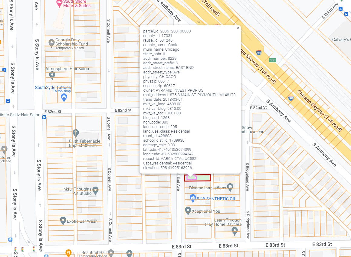
Smart Surveyor software is designed for land surveyors and real estate professionals who need accurate property data to make informed decisions. It solves the problem of incomplete or outdated parcel information by providing up to 26 property attributes per parcel, including APN, land use, school districts, market value, flood zone, and addresses. This leads to better project planning and more reliable results for clients.
How Smart Surveyor Solves Your Problems
- Comprehensive Data: Instead of wasting time gathering property details from multiple sources, users access nationwide parcel data in one place. This helps surveyors deliver detailed reports and make smarter recommendations.
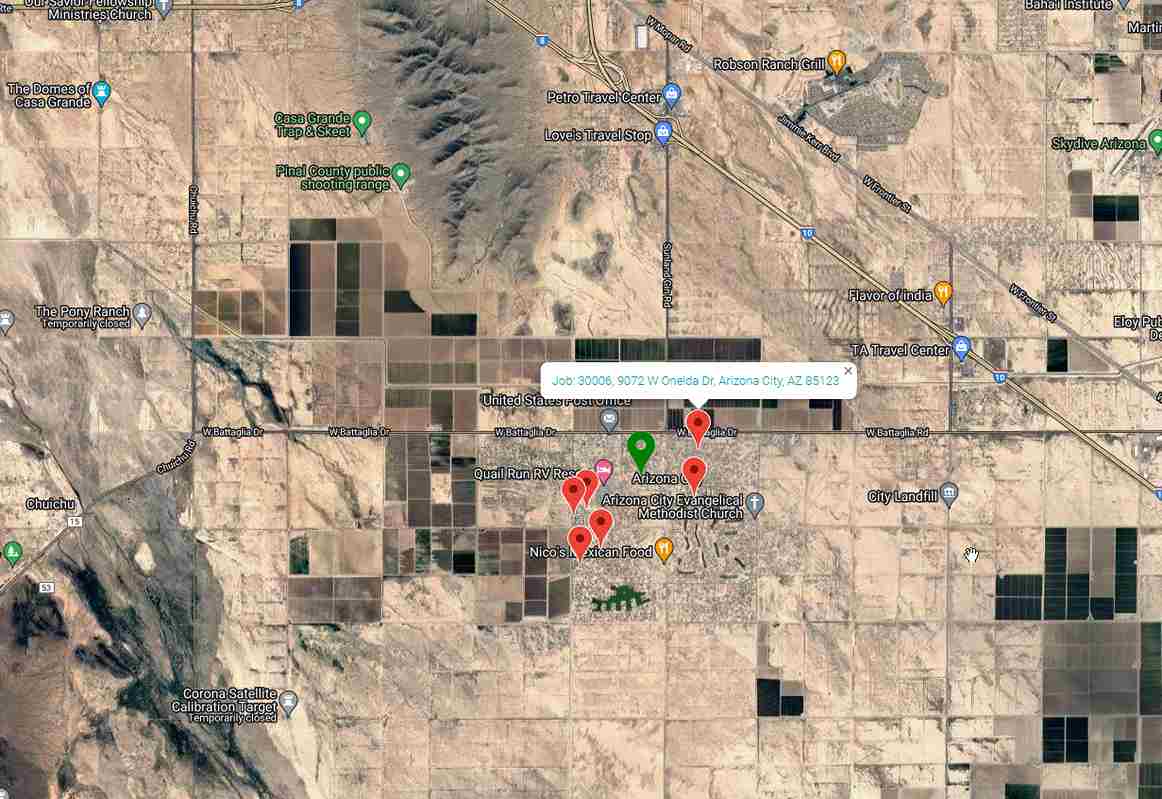
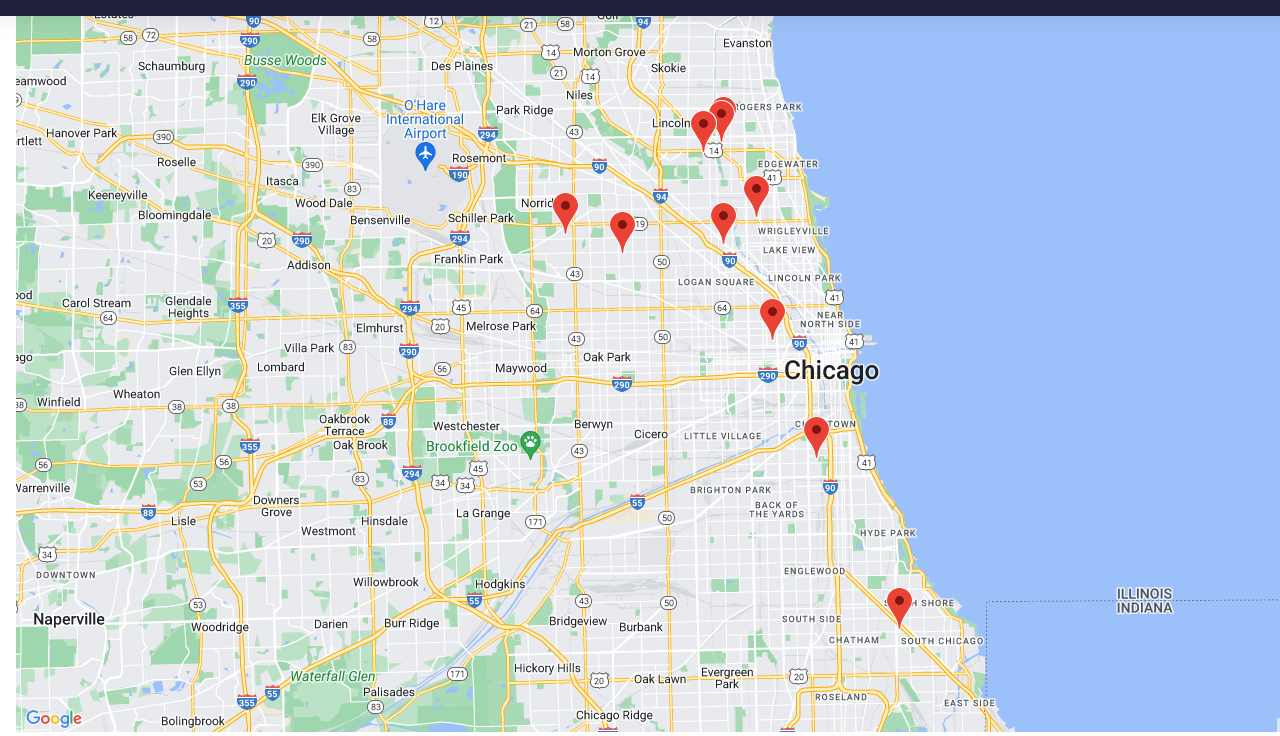
- Proximity Benefits: The map view lets you see all your past jobs in an area, so you can avoid duplicate work and plan efficiently.
Integration and Implementation
Smart Surveyor integrates with popular GIS and mapping tools, offering easy data export and seamless workflow with your existing systems. Implementation is straightforward and requires minimal training, keeping costs low.
Comparison with Other Survey Solutions
- Unlike traditional survey methods, Smart Surveyor provides real-time data updates and faster access to property information.
- Wearables and modern tools also boost efficiency, but Smart Surveyor's strength lies in its data depth and mapping features.
Choosing Smart Surveyor leads to lower costs, fewer errors, and faster project delivery compared to manual research or less integrated survey tools.
Smart Surveyor Features
Smart Surveyor Pricing
| Plan | Price | Model |
|---|---|---|
| Basic Plan | $5.00 | Per User |
| Premium Plan | $9.00 | Per User |